May 22, 2023
Ah, a bright sunny . . . Scratch that! A dark smokey Monday morning! It looks like most of Western Canada is on fire and the smoke is coming right down at us.
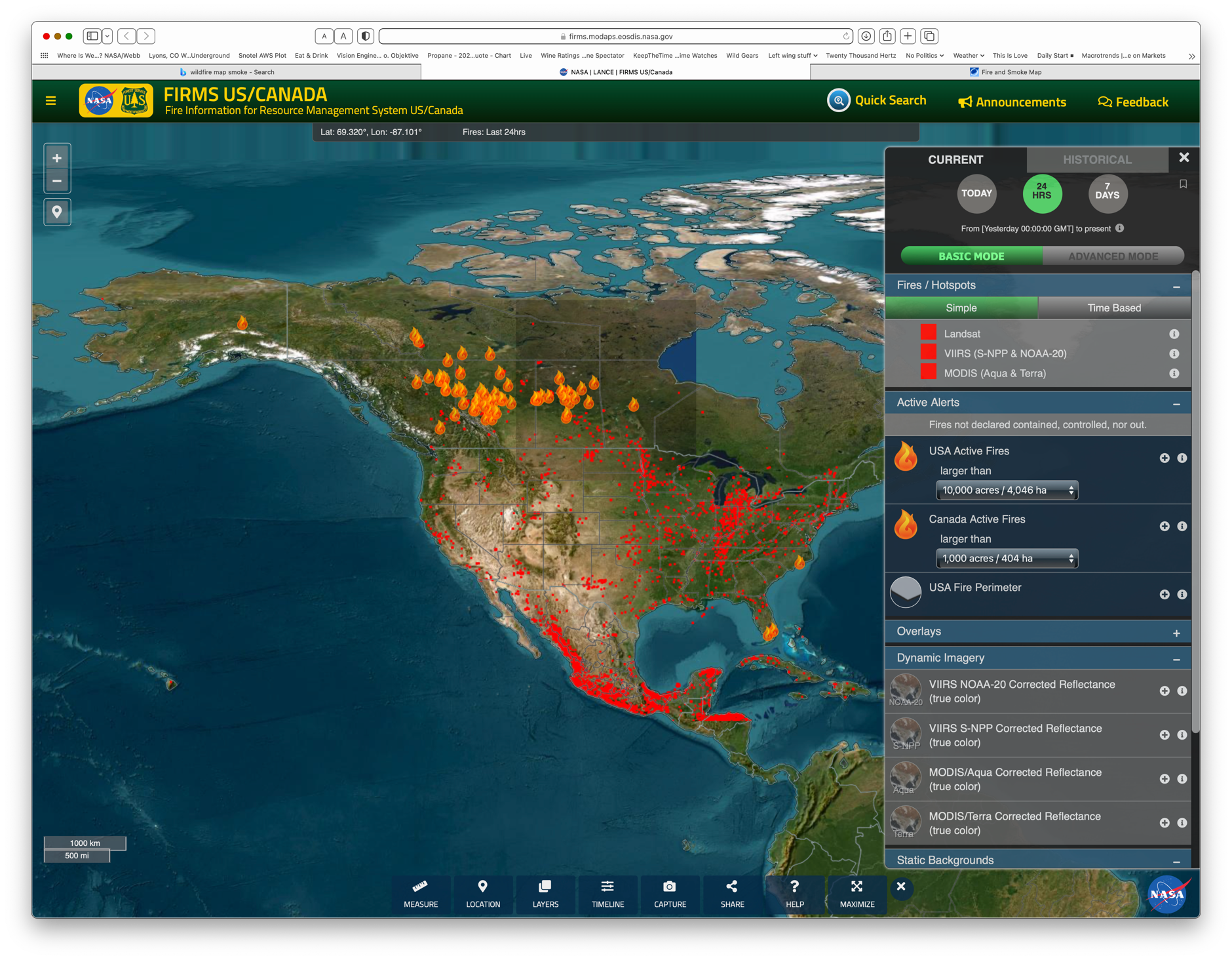
Here’s the fire map from https://firms.modaps.eosdis.nasa.gov/usfs/map/#d:24hrs;@-100.0,40.0,4z, with the “Larger than 10,000 acres” filter selected. That is a lot of Canada burning!
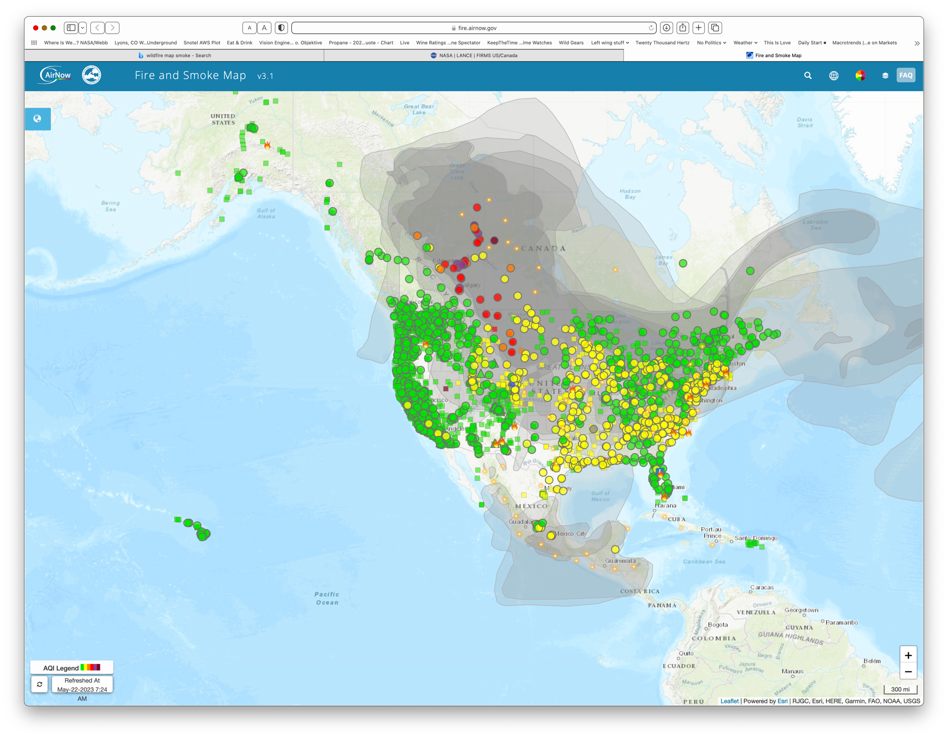
Here’s the smoke map from https://fire.airnow.gov. Each circle is an air monitoring station. This map only uses the PM2.5 readings to color code the circles. Green, yellow, orange and red mean “Ok”, “Stay indoors if you can”, “stay indoors” and “We really mean stay indoors”.
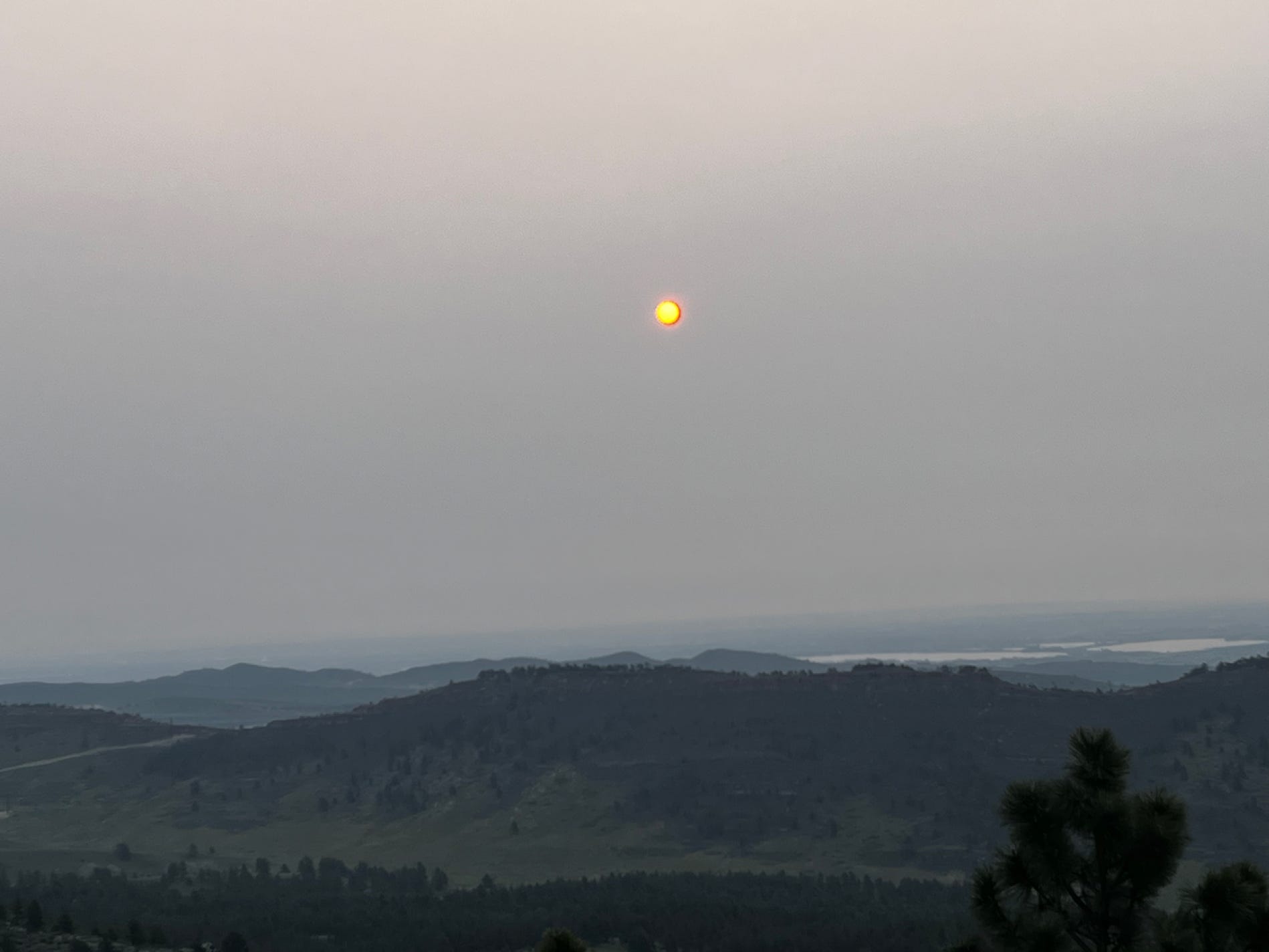
This is what it looked like a couple of hours after sunrise at 7:30 this morning. You can actually smell the wood smoke ☹️!