September 6, 2023
The winds have shifted enough to put us into the density 3 zone of the smoke map, so it’s really thick out there today. The fires have been moving west all summer long and now a lot of the smoke is coming from Alaska.
Let's start with what level 3 density smoke looks like - pretty darned thick.
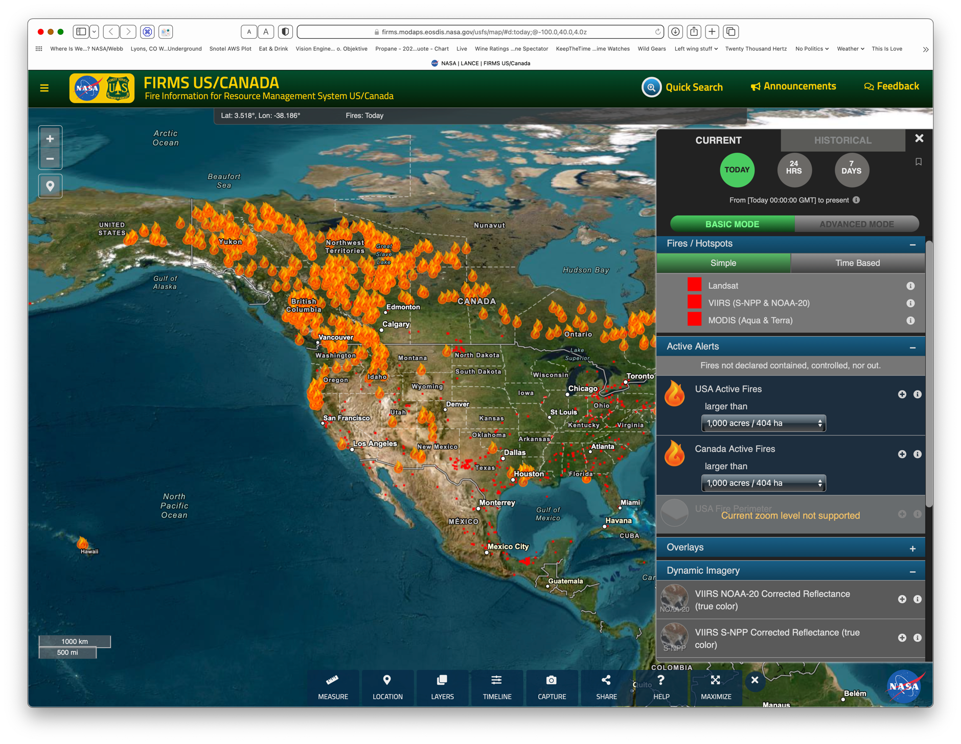
Here’s the fire map from https://firms.modaps.eosdis.nasa.gov/usfs/map/#d:24hrs;@-100.0,40.0,4z, with the “Larger than 10,000 acres” filter selected. If you compare it to May 22, 2023, you can clearly see just how much further west the fires are now.
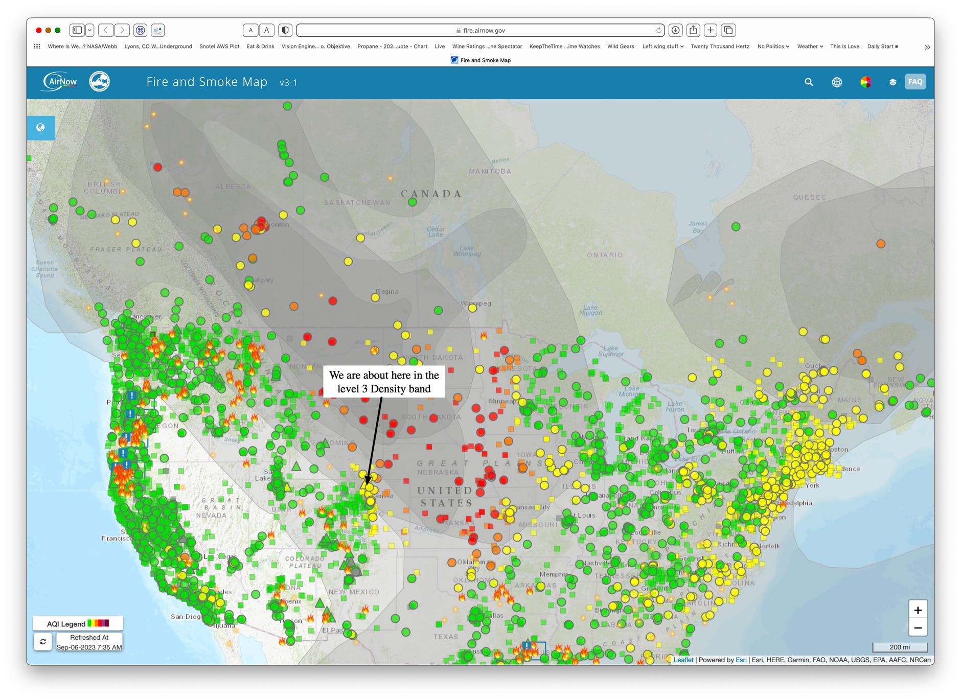
Here’s the smoke map from https://fire.airnow.gov. Each circle is an air monitoring station. This map only uses the PM2.5 readings to color code the circles. Green, yellow, orange and red mean “Ok”, “Stay indoors if you can”, “stay indoors” and “We really mean stay indoors”.
Notice that every station in Nebraska is red. The wildfires in Colorado, on the west slope, aren’t putting out enough smoke to even move their local stations up to level 3 density.